abstract
The Dislocating Ulysses project developed for Dr. Jentery Sayers’s English 507 course combines traditional literary analysis, archival research, mapping and 3D modelling techniques in order to ask how might our data be embodied and felt. Following the course objectives, we developed a prototype for mapping readers’ geotemporal experiences of James Joyce’s Ulysses for The Long Now of Ulysses Exhibit. This project builds and diverges from a long history of Ulysses mapping projects by moving away from mapping the journey of characters to mapping the reader experience of Dublin. In the process, the project attempts to unite both the temporal and the geospatial in order to rethink Ulysses in relation to the space of Dublin, the history of Dublin, as well as the reader of Ulysses. The project, which has been presented at the Canadian Society for Digital Humanities and Modernist Studies Association conferences, has since inspired what is now called the Z-Axis research project for the Modernist Versions Project which will continue to explore ways of making literary arguments through the intersection of archival, mapping and print fabrication techniques. The Z-Axis approach uses warping and distortion to articulate critical arguments through built media, emphasizing embodied experiences and subjective encounters with data.
Download the Tactile Map prototype (.obj).
workflow
The 3D map was created by scanning a 1925 survey map of Dublin, converting the scanned map into a displacement map, and then applying it to a 3D mesh in Autodesk Mudbox. A data model was developed to track the number of words used to describe each section of Dublin; that model provided strength rations for each section of Dublin described in Ulysses, ratios which were applied to the 3D map using the bulge tool in Mudbox to create the warped haystacks that populate the tactile map.
Download the displacement map (.raw) and Data Model (.xlsx).
Read more about the workflow used to produce the tactile map and our data model here.
Creating the Tactile Map
|
1) The 3D mesh (plane) in Mudbox (full size) 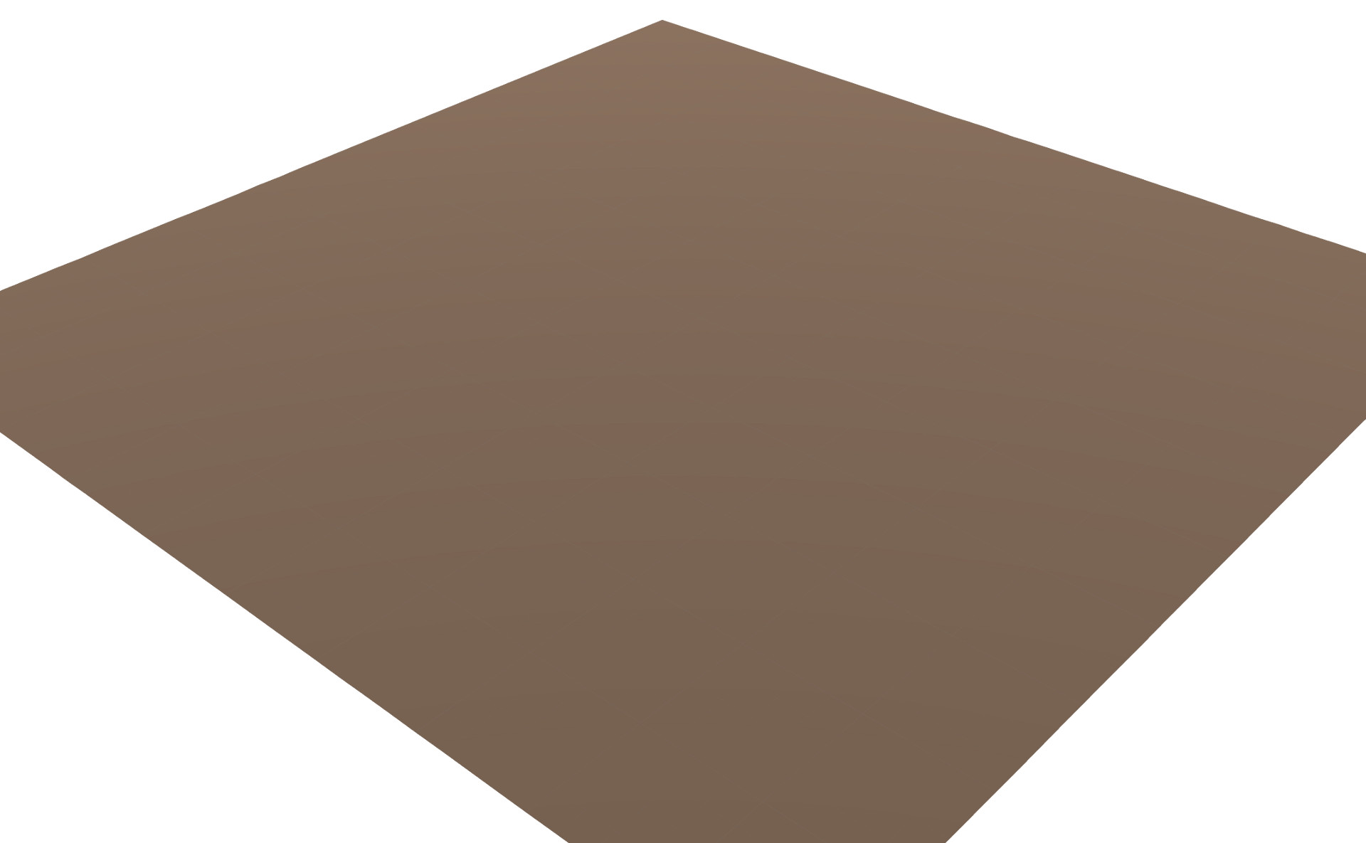
|
2 The scanned map overlaid upon the plane (full size) 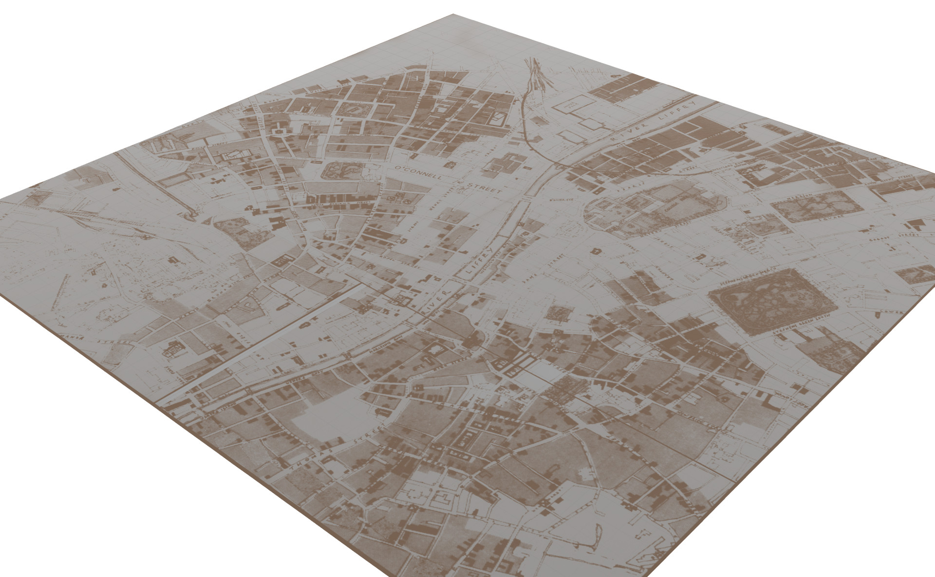
|
|
3) The displacement map applied to the plane (full size) 
|
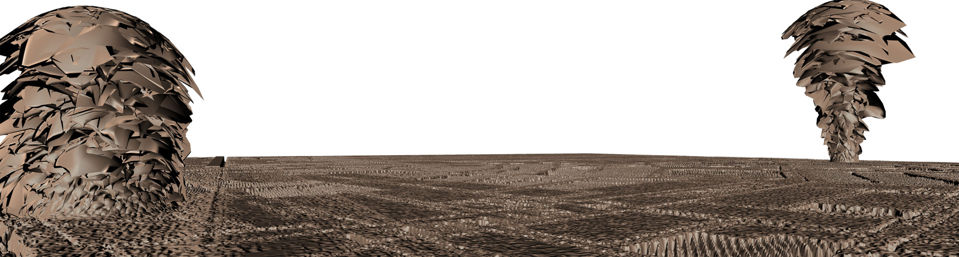
4) The 3D map warped along its z-axis (full size) 
|